Tennessee Landforms -- waterfalls| WGS84 |
| 36.143550 | -84.471880 |
| 36° 8.613'N | 84° 28.313'W |
| 36° 8' 36.8"N | 84° 28' 18.8"W |
| 16S 727462E 4002831N |
| convert to NAD27 |
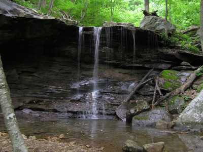
Emory Gap Falls 25'
Waypoint: MGF004 36.143550,-84.471880
County: Morgan landforms of Morgan county
Locale: FrozenHead
popup list of
nearby landforms (mileage, bearing)
MAPS
Select one of the following maps to display this waypoint (WGS84).
GPS
Remarks:
Tennessee landforms
home
arches
waterfalls
rocks
peaks
balds
sinks
lakes
regions
county
GSMNP landforms (TN/NC)
BSF landforms (TN/KY)
or nearby
lookout towers
 ©
Tom Dunigan
©
Tom Dunigan