Tennessee Landforms -- waterfalls| WGS84 |
| 36.139300 | -84.477700 |
| 36° 8.358'N | 84° 28.662'W |
| 36° 8' 21.5"N | 84° 28' 39.7"W |
| 16S 726951E 4002346N |
| convert to NAD27 |
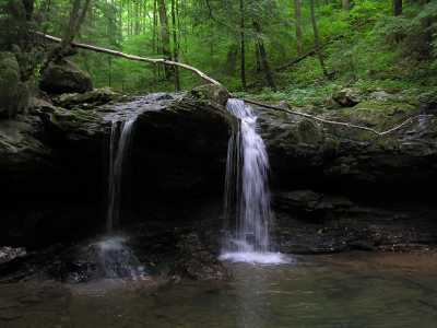
Debord Falls 12'
Waypoint: MGF002 36.139300,-84.477700
County: Morgan landforms of Morgan county
Locale: FrozenHead
popup list of
nearby landforms (mileage, bearing)
MAPS
Select one of the following maps to display this waypoint (WGS84).
GPS
Remarks:
Tennessee landforms
home
arches
waterfalls
rocks
peaks
balds
sinks
lakes
regions
county
GSMNP landforms (TN/NC)
BSF landforms (TN/KY)
or nearby
lookout towers
 ©
Tom Dunigan
©
Tom Dunigan