Tennessee Landforms -- waterfalls| WGS84 |
| 36.026512 | -84.424974 |
| 36° 1.591'N | 84° 25.498'W |
| 36° 1' 35.5"N | 84° 25' 29.9"W |
| 16S 732028E 3989957N |
| convert to NAD27 |
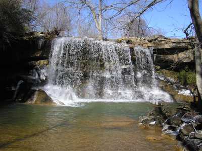
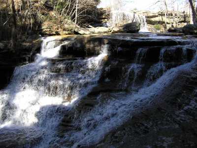
Coalfield Falls 15'
Waypoint: MGF001 36.026512,-84.424974
County: Morgan landforms of Morgan county
Locale: private
popup list of
nearby landforms (mileage, bearing)
MAPS
Select one of the following maps to display this waypoint (WGS84).
GPS
Remarks:
Also known as Ruffner Falls.
The upper falls is about 15', the lower cascade about 25'.
Tennessee landforms
home
arches
waterfalls
rocks
peaks
balds
sinks
lakes
regions
county
GSMNP landforms (TN/NC)
BSF landforms (TN/KY)
or nearby
lookout towers
 ©
Tom Dunigan
©
Tom Dunigan