Tennessee Landforms -- arches and natural bridges| WGS84 |
| 36.147130 | -84.501492 |
| 36° 8.828'N | 84° 30.09'W |
| 36° 8' 49.7"N | 84° 30' 5.4"W |
| 16S 724787E 4003160N |
| convert to NAD27 |
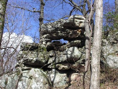
West Castle Rock Arch 4x1
Waypoint: MGA019 36.147130,-84.501492
County: Morgan landforms of Morgan county
Locale: Cumberland Trail
NABSQNO 16S-724787-4003160
popup list of
nearby landforms (mileage, bearing)
MAPS
Select one of the following maps to display this waypoint (WGS84).
GPS
Remarks:
Tennessee landforms
home
arches
waterfalls
rocks
peaks
balds
sinks
lakes
regions
county
GSMNP landforms (TN/NC)
BSF landforms (TN/KY)
or nearby
lookout towers
 ©
Tom Dunigan
©
Tom Dunigan