Tennessee Landforms -- arches and natural bridges| WGS84 |
| 35.989410 | -84.571490 |
| 35° 59.365'N | 84° 34.289'W |
| 35° 59' 21.9"N | 84° 34' 17.3"W |
| 16S 718926E 3985501N |
| convert to NAD27 |
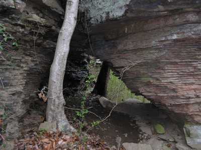
Horse Pen Br Arch 8x4
Waypoint: MGA014 35.989410,-84.571490
County: Morgan landforms of Morgan county
Locale: private
NABSQNO 16S-718926-3985501
popup list of
nearby landforms (mileage, bearing)
MAPS
Select one of the following maps to display this waypoint (WGS84).
GPS
Remarks:
Tennessee landforms
home
arches
waterfalls
rocks
peaks
balds
sinks
lakes
regions
county
GSMNP landforms (TN/NC)
BSF landforms (TN/KY)
or nearby
lookout towers
 ©
Tom Dunigan
©
Tom Dunigan