Tennessee Landforms -- arches and natural bridges| WGS84 |
| 36.118730 | -84.803700 |
| 36° 7.124'N | 84° 48.222'W |
| 36° 7' 7.4"N | 84° 48' 13.3"W |
| 16S 697665E 3999351N |
| convert to NAD27 |
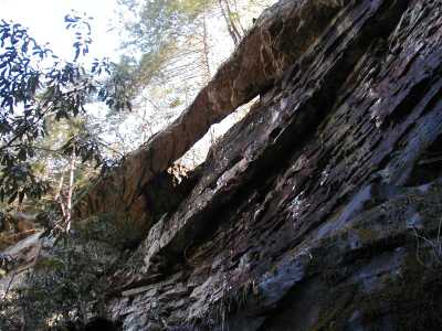
Barnett's Rib 60x50
Waypoint: MGA001 36.118730,-84.803700
County: Morgan landforms of Morgan county
Locale: Obed Wild & Scenic River
NABSQNO 16S-697665-3999351
popup list of
nearby landforms (mileage, bearing)
MAPS
Select one of the following maps to display this waypoint (WGS84).
GPS
Remarks:
Reported by Todd Fife. (off-trail)
Tennessee landforms
home
arches
waterfalls
rocks
peaks
balds
sinks
lakes
regions
county
GSMNP landforms (TN/NC)
BSF landforms (TN/KY)
or nearby
lookout towers
 ©
Tom Dunigan
©
Tom Dunigan