Tennessee Landforms -- rock formations| WGS84 |
| 35.548733 | -84.796147 |
| 35° 32.924'N | 84° 47.769'W |
| 35° 32' 55.4"N | 84° 47' 46.1"W |
| 16S 699770E 3936133N |
| convert to NAD27 |
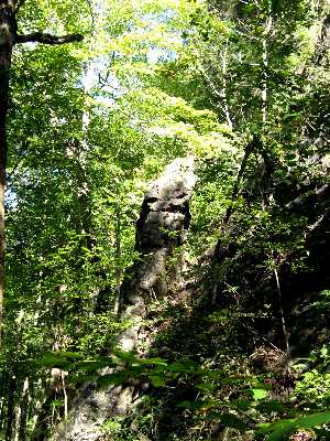
Eaves Chimney
Waypoint: MER001 35.548733,-84.796147
County: Meigs landforms of Meigs county
popup list of
nearby landforms (mileage, bearing)
MAPS
Select one of the following maps to display this waypoint (WGS84).
GPS
Remarks:
Reference and photo: Chris Oliver
Tennessee landforms
home
arches
waterfalls
rocks
peaks
balds
sinks
lakes
regions
county
GSMNP landforms (TN/NC)
BSF landforms (TN/KY)
or nearby
lookout towers
 ©
Tom Dunigan
©
Tom Dunigan