Tennessee Landforms -- waterfalls| WGS84 |
| 35.784730 | -84.340170 |
| 35° 47.084'N | 84° 20.41'W |
| 35° 47' 5"N | 84° 20' 24.6"W |
| 16S 740401E 3963337N |
| convert to NAD27 |
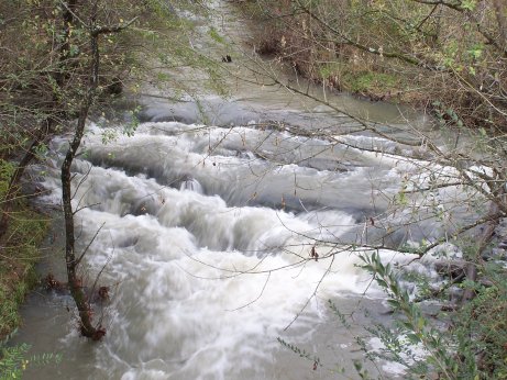
Hotchkiss Creek Cascade 4'
Waypoint: LOF001 35.784730,-84.340170
County: Loudon landforms of Loudon county
Locale: private
popup list of
nearby landforms (mileage, bearing)
MAPS
Select one of the following maps to display this waypoint (WGS84).
GPS
Remarks:
Reference & photo: Robert Robbins
Robert has been determined to find a falls in Loudon County.
This will have to do.
Tennessee landforms
home
arches
waterfalls
rocks
peaks
balds
sinks
lakes
regions
county
GSMNP landforms (TN/NC)
BSF landforms (TN/KY)
or nearby
lookout towers
 ©
Tom Dunigan
©
Tom Dunigan