 Photo by Gregory Plumb, Author of
Waterfalls of Tennessee
Photo by Gregory Plumb, Author of
Waterfalls of Tennessee
| WGS84 | |
| 35.530830 | -87.314440 |
| 35° 31.85'N | 87° 18.866'W |
| 35° 31' 51"N | 87° 18' 52"W |
| 16S 471493E 3931958N | |
| convert to NAD27 | |
MAPS
Select one of the following maps to display this waypoint (WGS84).
GPS
Remarks:
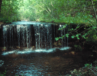
Photo by Gregory Plumb, Author of
Waterfalls of Tennessee