| WGS84 | |
| 35.957100 | -83.863500 |
| 35° 57.426'N | 83° 51.81'W |
| 35° 57' 25.6"N | 83° 51' 48.6"W |
| 17S 241746E 3982981N | |
| convert to NAD27 | |
MAPS
Select one of the following maps to display this waypoint (WGS84).
GPS
Remarks:
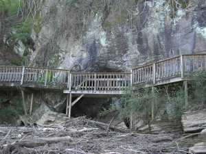
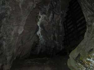
Reference: this is likely the "marble arch" referred to in Corgan & Parks #9 pg 95.
This partial arch with an Ijams Nature Center boardwalk across its face is cut out of the limestone bluff on the edge of the lake.