Tennessee Landforms -- waterfalls| WGS84 |
| 36.605380 | -81.684640 |
| 36° 36.323'N | 81° 41.078'W |
| 36° 36' 19.4"N | 81° 41' 4.7"W |
| 17S 438770E 4051315N |
| convert to NAD27 |
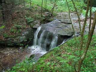
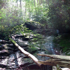
Whetstone Branch Falls
Waypoint: JOF007 36.605380,-81.684640
County: Johnson landforms of Johnson county
Locale: Cherokee National Forest
popup list of
nearby landforms (mileage, bearing)
MAPS
Select one of the following maps to display this waypoint (WGS84).
GPS
Remarks:
Reference: Benjamin Trotter, photo Bob Harvery
Along USFS 124
Dave Aldridge reports uppper falls at
36.60419,-81.68569
Tennessee landforms
home
arches
waterfalls
rocks
peaks
balds
sinks
lakes
regions
county
GSMNP landforms (TN/NC)
BSF landforms (TN/KY)
or nearby
lookout towers
 ©
Tom Dunigan
©
Tom Dunigan