Tennessee Landforms -- waterfalls| WGS84 |
| 36.592200 | -81.815500 |
| 36° 35.532'N | 81° 48.93'W |
| 36° 35' 31.9"N | 81° 48' 55.8"W |
| 17S 427054E 4049945N |
| convert to NAD27 |
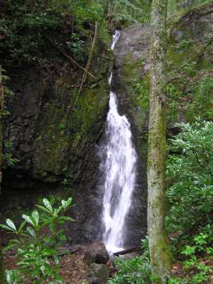
Backbone Falls 40'
Waypoint: JOF002 36.592200,-81.815500
County: Johnson landforms of Johnson county
Locale: Cherokee National Forest
popup list of
nearby landforms (mileage, bearing)
MAPS
Select one of the following maps to display this waypoint (WGS84).
GPS
Remarks:
CNF trail 198 at Backbone Rock
Tennessee landforms
home
arches
waterfalls
rocks
peaks
balds
sinks
lakes
regions
county
GSMNP landforms (TN/NC)
BSF landforms (TN/KY)
or nearby
lookout towers
 ©
Tom Dunigan
©
Tom Dunigan