 Photo by Gregory Plumb, Author of
Waterfalls of Tennessee
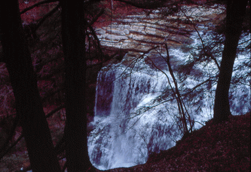
Photo by Gregory Plumb, Author of
Waterfalls of Tennessee
| WGS84 | |
| 36.248954 | -85.569860 |
| 36° 14.937'N | 85° 34.192'W |
| 36° 14' 56.2"N | 85° 34' 11.5"W |
| 16S 628493E 4012510N | |
| convert to NAD27 | |
MAPS
Select one of the following maps to display this waypoint (WGS84).
GPS
Remarks:
Became a state park in 2012.
Photo by Gregory Plumb, Author of
Waterfalls of Tennessee
Chuck Sutherland photo and wikipedia photo