 or hi-res
Tennessee landforms
home
arches
waterfalls
rocks
peaks
balds
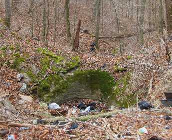
sinks
lakes
regions
county
or hi-res
Tennessee landforms
home
arches
waterfalls
rocks
peaks
balds
sinks
lakes
regions
county
GSMNP landforms (TN/NC) BSF landforms (TN/KY) or nearby lookout towers
| WGS84 | |
| 36.424722 | -85.747778 |
| 36° 25.483'N | 85° 44.867'W |
| 36° 25' 29"N | 85° 44' 52"W |
| 16S 612254E 4031786N | |
| convert to NAD27 | |
MAPS
Select one of the following maps to display this waypoint (WGS84).
GPS
Remarks:
Reference and photo:Kristen Bobo
or hi-res
Tennessee landforms
home
arches
waterfalls
rocks
peaks
balds
sinks
lakes
regions
county
GSMNP landforms (TN/NC)
BSF landforms (TN/KY)
or nearby
lookout towers