Tennessee Landforms -- waterfalls| WGS84 |
| 36.447000 | -83.175200 |
| 36° 26.82'N | 83° 10.512'W |
| 36° 26' 49.2"N | 83° 10' 30.7"W |
| 17S 305053E 4035728N |
| convert to NAD27 |
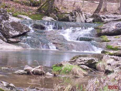
Friendship Falls 7'
Waypoint: HWF006 36.447000,-83.175200
County: Hawkins landforms of Hawkins county
popup list of
nearby landforms (mileage, bearing)
MAPS
Select one of the following maps to display this waypoint (WGS84).
GPS
Remarks:
Reference & photo: Robert Robbins
Tennessee landforms
home
arches
waterfalls
rocks
peaks
balds
sinks
lakes
regions
county
GSMNP landforms (TN/NC)
BSF landforms (TN/KY)
or nearby
lookout towers
 ©
Tom Dunigan
©
Tom Dunigan