Tennessee Landforms -- waterfalls| WGS84 |
| 36.484700 | -82.674900 |
| 36° 29.082'N | 82° 40.494'W |
| 36° 29' 4.9"N | 82° 40' 29.6"W |
| 17S 349968E 4039015N |
| convert to NAD27 |
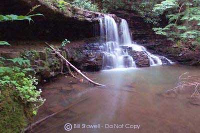
Laurel Run Falls 10'
Waypoint: HWF002 36.484700,-82.674900
County: Hawkins landforms of Hawkins county
Locale: park
popup list of
nearby landforms (mileage, bearing)
MAPS
Select one of the following maps to display this waypoint (WGS84).
GPS
Remarks:
Reference and photo: Bill Stowell
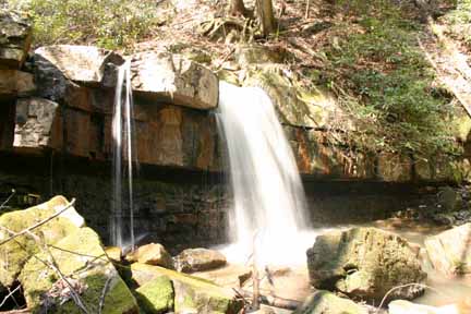
another 20' falls further upstream at
36.48277 -82.672317
Tennessee landforms
home
arches
waterfalls
rocks
peaks
balds
sinks
lakes
regions
county
GSMNP landforms (TN/NC)
BSF landforms (TN/KY)
or nearby
lookout towers
 ©
Tom Dunigan
©
Tom Dunigan