Tennessee Landforms -- waterfalls| WGS84 |
| 36.503190 | -83.233430 |
| 36° 30.191'N | 83° 14.006'W |
| 36° 30' 11.5"N | 83° 14' 0.4"W |
| 17S 299978E 4042082N |
| convert to NAD27 |
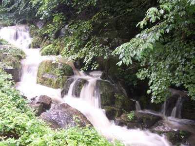
Duck Creek Falls 8'
Waypoint: HNF010 36.503190,-83.233430
County: Hancock landforms of Hancock county
Locale: private
popup list of
nearby landforms (mileage, bearing)
MAPS
Select one of the following maps to display this waypoint (WGS84).
GPS
Remarks:
Reference & photo: Robert Robbins
Tennessee landforms
home
arches
waterfalls
rocks
peaks
balds
sinks
lakes
regions
county
GSMNP landforms (TN/NC)
BSF landforms (TN/KY)
or nearby
lookout towers
 ©
Tom Dunigan
©
Tom Dunigan