Tennessee Landforms -- waterfalls| WGS84 |
| 36.474160 | -83.268610 |
| 36° 28.45'N | 83° 16.117'W |
| 36° 28' 27"N | 83° 16' 7"W |
| 17S 296751E 4038935N |
| convert to NAD27 |
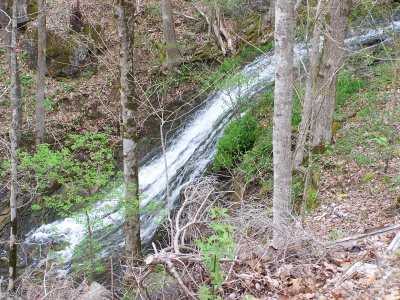
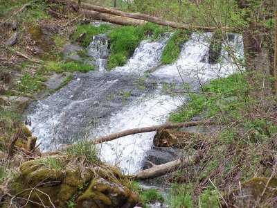
Yellow Branch Falls(3) 20'
Waypoint: HNF009 36.474160,-83.268610
County: Hancock landforms of Hancock county
Locale: private
popup list of
nearby landforms (mileage, bearing)
MAPS
Select one of the following maps to display this waypoint (WGS84).
GPS
Remarks:
Reference & photo: Robert Robbins
Tennessee landforms
home
arches
waterfalls
rocks
peaks
balds
sinks
lakes
regions
county
GSMNP landforms (TN/NC)
BSF landforms (TN/KY)
or nearby
lookout towers
 ©
Tom Dunigan
©
Tom Dunigan