Tennessee Landforms -- arches and natural bridges| WGS84 |
| 36.413600 | -83.260000 |
| 36° 24.816'N | 83° 15.6'W |
| 36° 24' 49"N | 83° 15' 36"W |
| 17S 297365E 4032197N |
| convert to NAD27 |
Rock Bridge Church NB
Waypoint: HNA001 36.413600,-83.260000
County: Hancock landforms of Hancock county
Locale: road
NABSQNO 17S-297365-4032197
popup list of
nearby landforms (mileage, bearing)
MAPS
Select one of the following maps to display this waypoint (WGS84).
GPS
Remarks:
References: C/P:35
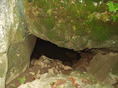
The road passes over this natural bridge and the creek seeps under
it. Not visually significant.
Tennessee landforms
home
arches
waterfalls
rocks
peaks
balds
sinks
lakes
regions
county
GSMNP landforms (TN/NC)
BSF landforms (TN/KY)
or nearby
lookout towers
 ©
Tom Dunigan
©
Tom Dunigan