Tennessee Landforms -- waterfalls| WGS84 |
| 35.351950 | -85.169880 |
| 35° 21.117'N | 85° 10.193'W |
| 35° 21' 7"N | 85° 10' 11.6"W |
| 16S 666293E 3913611N |
| convert to NAD27 |
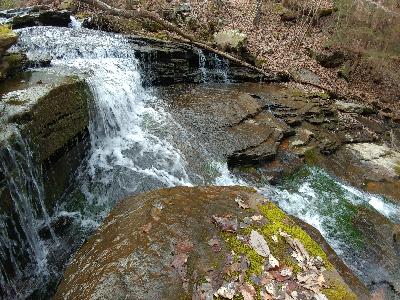
Picnic Falls 10'
Waypoint: HMF033 35.351950,-85.169880
County: Hamilton landforms of Hamilton county
Locale: Cumberland Trail
popup list of
nearby landforms (mileage, bearing)
MAPS
Select one of the following maps to display this waypoint (WGS84).
GPS
Remarks:
Reference and photo: Christopher Lewis
Tennessee landforms
home
arches
waterfalls
rocks
peaks
balds
sinks
lakes
regions
county
GSMNP landforms (TN/NC)
BSF landforms (TN/KY)
or nearby
lookout towers
 ©
Tom Dunigan
©
Tom Dunigan