Tennessee Landforms -- waterfalls| WGS84 |
| 35.195290 | -85.298800 |
| 35° 11.717'N | 85° 17.928'W |
| 35° 11' 43"N | 85° 17' 55.7"W |
| 16S 654875E 3896026N |
| convert to NAD27 |
Ginger Falls(2) 30'
Waypoint: HMF028 35.195290,-85.298800
County: Hamilton landforms of Hamilton county
popup list of
nearby landforms (mileage, bearing)
MAPS
Select one of the following maps to display this waypoint (WGS84).
GPS
Remarks:
Reference: Christopher Lewis, photos Daniel Jack Hutchison
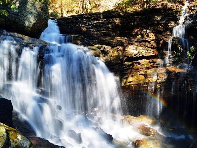 lower falls
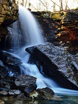 upper falls
Tennessee landforms
home
arches
waterfalls
rocks
peaks
balds
sinks
lakes
regions
county
GSMNP landforms (TN/NC)
BSF landforms (TN/KY)
or nearby
lookout towers
 ©
Tom Dunigan
©
Tom Dunigan