Tennessee Landforms -- waterfalls| WGS84 |
| 35.267838 | -85.263735 |
| 35° 16.07'N | 85° 15.824'W |
| 35° 16' 4.2"N | 85° 15' 49.4"W |
| 16S 657927E 3904128N |
| convert to NAD27 |
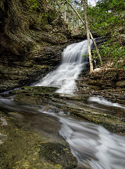
Stevenson Br Falls 20'
Waypoint: HMF020 35.267838,-85.263735
County: Hamilton landforms of Hamilton county
Locale: Cumberland Trail
popup list of
nearby landforms (mileage, bearing)
MAPS
Select one of the following maps to display this waypoint (WGS84).
GPS
Remarks:
Reference and photo: Barry Cole
Tennessee landforms
home
arches
waterfalls
rocks
peaks
balds
sinks
lakes
regions
county
GSMNP landforms (TN/NC)
BSF landforms (TN/KY)
or nearby
lookout towers
 ©
Tom Dunigan
©
Tom Dunigan