Tennessee Landforms -- waterfalls| WGS84 |
| 35.434300 | -85.696240 |
| 35° 26.058'N | 85° 41.774'W |
| 35° 26' 3.5"N | 85° 41' 46.4"W |
| 16S 618342E 3921988N |
| convert to NAD27 |
Greeter Falls (u/l) 50'
Waypoint: GUF008 35.434300,-85.696240
County: Grundy landforms of Grundy county
Locale: SavageGulf
popup list of
nearby landforms (mileage, bearing)
MAPS
Select one of the following maps to display this waypoint (WGS84).
GPS
Remarks:
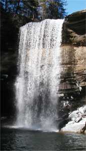 Greeter Falls
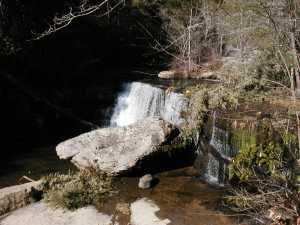 upper Greeter Falls 15'
Tennessee landforms
home
arches
waterfalls
rocks
peaks
balds
sinks
lakes
regions
county
GSMNP landforms (TN/NC)
BSF landforms (TN/KY)
or nearby
lookout towers
 ©
Tom Dunigan
©
Tom Dunigan