Tennessee Landforms -- arches and natural bridges| WGS84 |
| 35.351100 | -85.810600 |
| 35° 21.066'N | 85° 48.636'W |
| 35° 21' 4"N | 85° 48' 38.2"W |
| 16S 608072E 3912629N |
| convert to NAD27 |
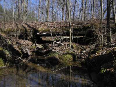
Burrow Cove Natural Bridge 25x3
Waypoint: GUA001 35.351100,-85.810600
County: Grundy landforms of Grundy county
Locale: private
NABSQNO 16S-608072-3912629
popup list of
nearby landforms (mileage, bearing)
MAPS
Select one of the following maps to display this waypoint (WGS84).
GPS
Remarks:
References: C/P:10,USGS
Tennessee landforms
home
arches
waterfalls
rocks
peaks
balds
sinks
lakes
regions
county
GSMNP landforms (TN/NC)
BSF landforms (TN/KY)
or nearby
lookout towers
 ©
Tom Dunigan
©
Tom Dunigan