Tennessee Landforms -- waterfalls| WGS84 |
| 36.399630 | -83.391490 |
| 36° 23.978'N | 83° 23.489'W |
| 36° 23' 58.7"N | 83° 23' 29.3"W |
| 17S 285535E 4030932N |
| convert to NAD27 |
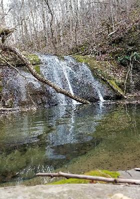
Cedar Springs Creek Falls (2)
Waypoint: GRF012 36.399630,-83.391490
County: Grainger landforms of Grainger county
Locale: private
popup list of
nearby landforms (mileage, bearing)
MAPS
Select one of the following maps to display this waypoint (WGS84).
GPS
Remarks:
Reference & photo: Robert Robbins
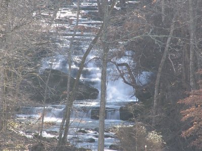
Sharon Blackstock reports 20' upper falls at
36.398685,-83.390669
Tennessee landforms
home
arches
waterfalls
rocks
peaks
balds
sinks
lakes
regions
county
GSMNP landforms (TN/NC)
BSF landforms (TN/KY)
or nearby
lookout towers
 ©
Tom Dunigan
©
Tom Dunigan