Tennessee Landforms -- waterfalls| WGS84 |
| 36.390400 | -83.407700 |
| 36° 23.424'N | 83° 24.462'W |
| 36° 23' 25.4"N | 83° 24' 27.7"W |
| 17S 284055E 4029944N |
| convert to NAD27 |
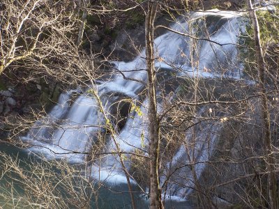
Joe Mill Cr Falls 30'
Waypoint: GRF001 36.390400,-83.407700
County: Grainger landforms of Grainger county
Locale: private
popup list of
nearby landforms (mileage, bearing)
MAPS
Select one of the following maps to display this waypoint (WGS84).
GPS
Remarks:
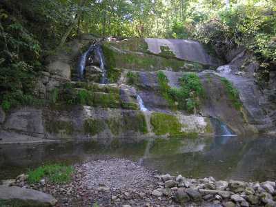
 courtesy of Robert Robbins
Tennessee landforms
home
arches
waterfalls
rocks
peaks
balds
sinks
lakes
regions
county
GSMNP landforms (TN/NC)
BSF landforms (TN/KY)
or nearby
lookout towers
 ©
Tom Dunigan
©
Tom Dunigan