Tennessee Landforms -- waterfalls| WGS84 |
| 36.344222 | -82.702147 |
| 36° 20.653'N | 82° 42.129'W |
| 36° 20' 39.2"N | 82° 42' 7.7"W |
| 17S 347252E 4023474N |
| convert to NAD27 |
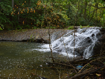
Clear Creek Falls 8'
Waypoint: GEF020 36.344222,-82.702147
County: Greene landforms of Greene county
popup list of
nearby landforms (mileage, bearing)
MAPS
Select one of the following maps to display this waypoint (WGS84).
GPS
Remarks:
Reference and photo: Sharon Blackstock
Tennessee landforms
home
arches
waterfalls
rocks
peaks
balds
sinks
lakes
regions
county
GSMNP landforms (TN/NC)
BSF landforms (TN/KY)
or nearby
lookout towers
 ©
Tom Dunigan
©
Tom Dunigan