 Photo by Gregory Plumb, Author of
Waterfalls of Tennessee
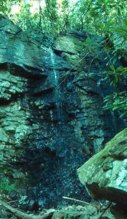
Photo by Gregory Plumb, Author of
Waterfalls of Tennessee
| WGS84 | |
| 36.087400 | -82.651200 |
| 36° 5.244'N | 82° 39.072'W |
| 36° 5' 14.6"N | 82° 39' 4.3"W |
| 17S 351339E 3994904N | |
| convert to NAD27 | |
MAPS
Select one of the following maps to display this waypoint (WGS84).
GPS
Remarks:
CNF trail 12
Photo by Gregory Plumb, Author of
Waterfalls of Tennessee