 courtesy Dave Aldridge
| WGS84 | |
| 36.055250 | -82.717600 |
| 36° 3.315'N | 82° 43.056'W |
| 36° 3' 18.9"N | 82° 43' 3.4"W |
| 17S 345298E 3991442N | |
| convert to NAD27 | |
MAPS
Select one of the following maps to display this waypoint (WGS84).
GPS
Remarks:
Reference: GPS coordinates courtesy of Wendell Dingus
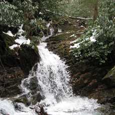
cascade and small falls above
Margarette falls.
courtesy Dave Aldridge