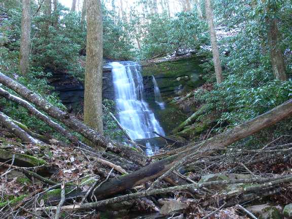
 Dave Aldridge photo
| WGS84 | |
| 36.058850 | -82.698100 |
| 36° 3.531'N | 82° 41.886'W |
| 36° 3' 31.9"N | 82° 41' 53.2"W |
| 17S 347061E 3991810N | |
| convert to NAD27 | |
MAPS
Select one of the following maps to display this waypoint (WGS84).
GPS
Remarks:
CNF trail 18
Dave Aldridge photo
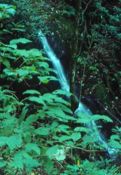 Davis Creek feeder falls 45' at
36.06125,-82.6987, photo by Gregory Plumb, Author of
Waterfalls of Tennessee
Davis Creek feeder falls 45' at
36.06125,-82.6987, photo by Gregory Plumb, Author of
Waterfalls of Tennessee