15' cascade in the upper (TN) portion of the canyon.
| WGS84 | |
| 34.990040 | -86.102950 |
| 34° 59.402'N | 86° 6.177'W |
| 34° 59' 24.1"N | 86° 6' 10.6"W |
| 16S 581868E 3872306N | |
| convert to NAD27 | |
MAPS
Select one of the following maps to display this waypoint (WGS84).
GPS
Remarks:
A narrow limestone canyon on the Tennessee/Alabama border (look at the topo map!). Nature Conservancy or Walls of Jericho article and photo of one of the falls.
trail map courtesy N. Walker, and a GPS track/elevation profile. A TN natural area. Also visit the gusher Mill Creek blowhole.
15' cascade in the upper (TN) portion of the canyon.

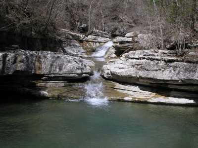
This 35' falls in TN (the waypoint)
plunges into a cave, and the water re-appears
out of a cave further downstream.
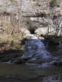
The water re-emerging from a cave. At high water the main channel
carries water as well!
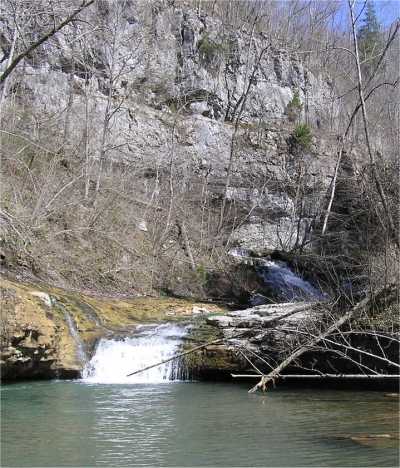
Looking upstream at a falls and the cascade from the cave.