 and another photo
| WGS84 | |
| 35.000410 | -86.072460 |
| 35° 0.025'N | 86° 4.348'W |
| 35° 0' 1.5"N | 86° 4' 20.9"W |
| 16S 584640E 3873482N | |
| convert to NAD27 | |
MAPS
Select one of the following maps to display this waypoint (WGS84).
GPS
Remarks:
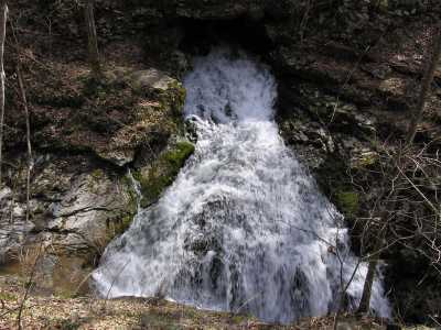
Mill Creek resurgence into a 40' cascade. Downstream are Walls of Jericho. See trails on Bear Hollow WMA map. or GPS track
and another photo