Tennessee Landforms -- waterfalls| WGS84 |
| 35.059240 | -86.038500 |
| 35° 3.554'N | 86° 2.31'W |
| 35° 3' 33.2"N | 86° 2' 18.6"W |
| 16S 587677E 3880035N |
| convert to NAD27 |
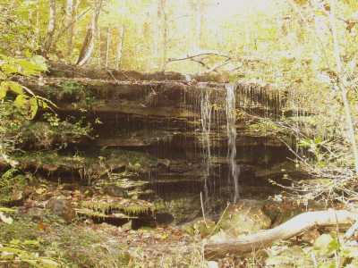
Cave Cove Falls 10'
Waypoint: FRF011 35.059240,-86.038500
County: Franklin landforms of Franklin county
Locale: private
popup list of
nearby landforms (mileage, bearing)
MAPS
Select one of the following maps to display this waypoint (WGS84).
GPS
Remarks:
Falls disappear into sinkhole. off-trail
Tennessee landforms
home
arches
waterfalls
rocks
peaks
balds
sinks
lakes
regions
county
GSMNP landforms (TN/NC)
BSF landforms (TN/KY)
or nearby
lookout towers
 ©
Tom Dunigan
©
Tom Dunigan