Tennessee Landforms -- arches and natural bridges| WGS84 |
| 35.120840 | -85.923300 |
| 35° 7.25'N | 85° 55.398'W |
| 35° 7' 15"N | 85° 55' 23.9"W |
| 16S 598108E 3886974N |
| convert to NAD27 |
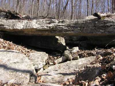
Buggy Top Natural Bridge 8x3
Waypoint: FRA005 35.120840,-85.923300
County: Franklin landforms of Franklin county
NABSQNO 16S-598108-3886974
popup list of
nearby landforms (mileage, bearing)
MAPS
Select one of the following maps to display this waypoint (WGS84).
GPS
Remarks:
Reference: Vic Fife
Tennessee landforms
home
arches
waterfalls
rocks
peaks
balds
sinks
lakes
regions
county
GSMNP landforms (TN/NC)
BSF landforms (TN/KY)
or nearby
lookout towers
 ©
Tom Dunigan
©
Tom Dunigan