Tennessee Landforms -- arches and natural bridges| WGS84 |
| 35.050680 | -86.015910 |
| 35° 3.041'N | 86° 0.955'W |
| 35° 3' 2.5"N | 86° 0' 57.3"W |
| 16S 589746E 3879106N |
| convert to NAD27 |
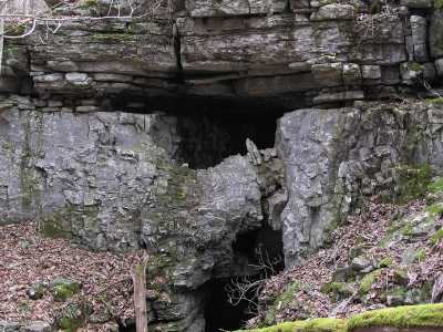
High Lintel 5x30
Waypoint: FRA003 35.050680,-86.015910
County: Franklin landforms of Franklin county
Locale: private
NABSQNO 16S-589746-3879106
popup list of
nearby landforms (mileage, bearing)
MAPS
Select one of the following maps to display this waypoint (WGS84).
GPS
Remarks:
This high limestone lintel hangs above the entrance to a cave in
a sinkhole. off-trail.
Tennessee landforms
home
arches
waterfalls
rocks
peaks
balds
sinks
lakes
regions
county
GSMNP landforms (TN/NC)
BSF landforms (TN/KY)
or nearby
lookout towers
 ©
Tom Dunigan
©
Tom Dunigan