Tennessee Landforms -- arches and natural bridges| WGS84 |
| 35.153460 | -85.921000 |
| 35° 9.208'N | 85° 55.26'W |
| 35° 9' 12.5"N | 85° 55' 15.6"W |
| 16S 598278E 3890594N |
| convert to NAD27 |
Sewanee Natural Bridge 50x30
Waypoint: FRA001 35.153460,-85.921000
County: Franklin landforms of Franklin county
Locale: SNA
NABSQNO 16S-598278-3890594
popup list of
nearby landforms (mileage, bearing)
MAPS
Select one of the following maps to display this waypoint (WGS84).
GPS
Remarks:
References: JNAD:TENN-24, C/P:9, USGS
There is also small tunnel/window on the south side of the arch.
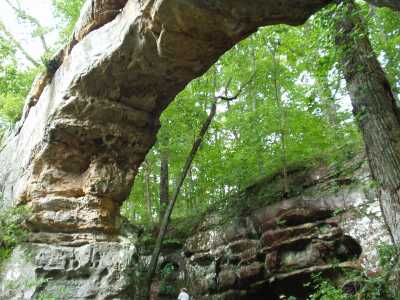
Chuck Sutherland photo
Tennessee landforms
home
arches
waterfalls
rocks
peaks
balds
sinks
lakes
regions
county
GSMNP landforms (TN/NC)
BSF landforms (TN/KY)
or nearby
lookout towers
 ©
Tom Dunigan
©
Tom Dunigan