Tennessee Landforms -- rock formations| WGS84 |
| 36.546200 | -84.903100 |
| 36° 32.772'N | 84° 54.186'W |
| 36° 32' 46.3"N | 84° 54' 11.2"W |
| 16S 687689E 4046578N |
| convert to NAD27 |
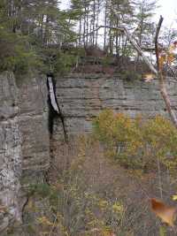
Black House Chimney 30'
Waypoint: FER003 36.546200,-84.903100
County: Fentress landforms of Fentress county
Locale: PSF
popup list of
nearby landforms (mileage, bearing)
MAPS
Select one of the following maps to display this waypoint (WGS84).
GPS
Remarks:
Tennessee landforms
home
arches
waterfalls
rocks
peaks
balds
sinks
lakes
regions
county
GSMNP landforms (TN/NC)
BSF landforms (TN/KY)
or nearby
lookout towers
 ©
Tom Dunigan
©
Tom Dunigan