Tennessee Landforms -- arches and natural bridges| WGS84 |
| 36.315611 | -85.010750 |
| 36° 18.937'N | 85° 0.645'W |
| 36° 18' 56.2"N | 85° 0' 38.7"W |
| 16S 678580E 4020792N |
| convert to NAD27 |
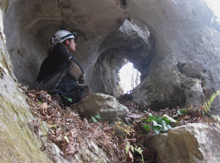
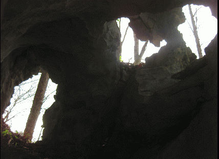
Canebrake Arch 4x4
Waypoint: FEA061 36.315611,-85.010750
County: Fentress landforms of Fentress county
Locale: Obey
NABSQNO 16S-678580-4020792
popup list of
nearby landforms (mileage, bearing)
MAPS
Select one of the following maps to display this waypoint (WGS84).
GPS
Remarks:
Reference and photos: Ken Pasternack and Kristen Bobo
Limestone arch with skylights.

Tennessee landforms
home
arches
waterfalls
rocks
peaks
balds
sinks
lakes
regions
county
GSMNP landforms (TN/NC)
BSF landforms (TN/KY)
or nearby
lookout towers
 ©
Tom Dunigan
©
Tom Dunigan