Tennessee Landforms -- arches and natural bridges| WGS84 |
| 36.504501 | -84.791288 |
| 36° 30.27'N | 84° 47.477'W |
| 36° 30' 16.2"N | 84° 47' 28.6"W |
| 16S 697805E 4042176N |
| convert to NAD27 |
Allan's Arch 75x8
Waypoint: FEA057 36.504501,-84.791288
County: Fentress landforms of Fentress county
NABSQNO 16S-697805-4042176
popup list of
nearby landforms (mileage, bearing)
MAPS
Select one of the following maps to display this waypoint (WGS84).
GPS
Remarks:
Reference: Alan Roberts
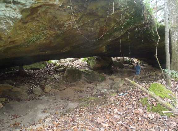 Ken Pasternack photo
Tennessee landforms
home
arches
waterfalls
rocks
peaks
balds
sinks
lakes
regions
county
GSMNP landforms (TN/NC)
BSF landforms (TN/KY)
or nearby
lookout towers
 ©
Tom Dunigan
©
Tom Dunigan