Tennessee Landforms -- arches and natural bridges| WGS84 |
| 36.208130 | -85.068040 |
| 36° 12.488'N | 85° 4.082'W |
| 36° 12' 29.3"N | 85° 4' 4.9"W |
| 16S 673674E 4008764N |
| convert to NAD27 |
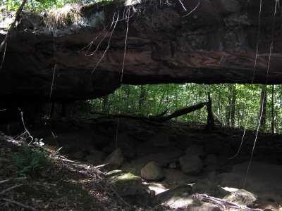
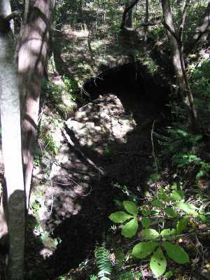
MW Arch 70x8
Waypoint: FEA050 36.208130,-85.068040
County: Fentress landforms of Fentress county
Locale: private
NABSQNO 16S-673674-4008764
popup list of
nearby landforms (mileage, bearing)
MAPS
Select one of the following maps to display this waypoint (WGS84).
GPS
Remarks:
Reference: Fentress county history and BG's photos
Martha Washington arch, top hole about 25' wide, base 70' wide.
AKA Horn Dog arch.
Tennessee landforms
home
arches
waterfalls
rocks
peaks
balds
sinks
lakes
regions
county
GSMNP landforms (TN/NC)
BSF landforms (TN/KY)
or nearby
lookout towers
 ©
Tom Dunigan
©
Tom Dunigan