Tennessee Landforms -- arches and natural bridges| WGS84 |
| 36.507400 | -84.769900 |
| 36° 30.444'N | 84° 46.194'W |
| 36° 30' 26.6"N | 84° 46' 11.6"W |
| 16S 699713E 4042542N |
| convert to NAD27 |
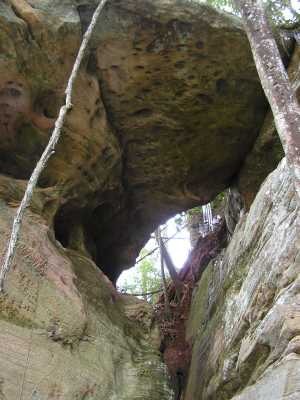
Rockhouse Br Overpass 18x20
Waypoint: FEA039 36.507400,-84.769900
County: Fentress landforms of Fentress county
Locale: Big South Fork
NABSQNO 16S-699713-4042542
popup list of
nearby landforms (mileage, bearing)
MAPS
Select one of the following maps to display this waypoint (WGS84).
GPS
Remarks:
off-trail, Rockhouse Branch Arch is nearby
Tennessee landforms
home
arches
waterfalls
rocks
peaks
balds
sinks
lakes
regions
county
GSMNP landforms (TN/NC)
BSF landforms (TN/KY)
or nearby
lookout towers
 ©
Tom Dunigan
©
Tom Dunigan