Tennessee Landforms -- arches and natural bridges| WGS84 |
| 36.428800 | -84.731900 |
| 36° 25.728'N | 84° 43.914'W |
| 36° 25' 43.7"N | 84° 43' 54.8"W |
| 16S 703322E 4033901N |
| convert to NAD27 |
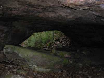
Zenith Arch 20x5
Waypoint: FEA038 36.428800,-84.731900
County: Fentress landforms of Fentress county
Locale: Big South Fork
NABSQNO 16S-703322-4033901
popup list of
nearby landforms (mileage, bearing)
MAPS
Select one of the following maps to display this waypoint (WGS84).
GPS
Remarks:
Reference: Gary Matthews
 off-trail
Tennessee landforms
home
arches
waterfalls
rocks
peaks
balds
sinks
lakes
regions
county
GSMNP landforms (TN/NC)
BSF landforms (TN/KY)
or nearby
lookout towers
 ©
Tom Dunigan
©
Tom Dunigan