Tennessee Landforms -- arches and natural bridges| WGS84 |
| 36.512600 | -84.779000 |
| 36° 30.756'N | 84° 46.74'W |
| 36° 30' 45.4"N | 84° 46' 44.4"W |
| 16S 698885E 4043100N |
| convert to NAD27 |
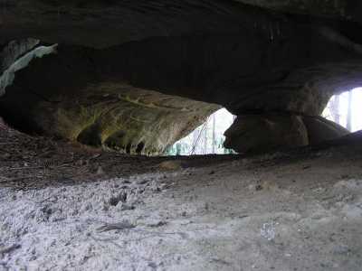
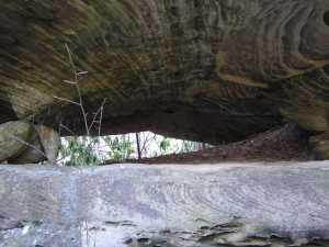
Cracked Foot Arch 17x4
Waypoint: FEA022 36.512600,-84.779000
County: Fentress landforms of Fentress county
Locale: Big South Fork
NABSQNO 16S-698885-4043100
popup list of
nearby landforms (mileage, bearing)
MAPS
Select one of the following maps to display this waypoint (WGS84).
GPS
Remarks:
nice arch between two drainages, off-trail
Tennessee landforms
home
arches
waterfalls
rocks
peaks
balds
sinks
lakes
regions
county
GSMNP landforms (TN/NC)
BSF landforms (TN/KY)
or nearby
lookout towers
 ©
Tom Dunigan
©
Tom Dunigan