| WGS84 | |
| 36.414267 | -84.947770 |
| 36° 24.856'N | 84° 56.866'W |
| 36° 24' 51.4"N | 84° 56' 52"W |
| 16S 684002E 4031855N | |
| convert to NAD27 | |
MAPS
Select one of the following maps to display this waypoint (WGS84).
GPS
Remarks:
References: JNAD:TENN-70,WPA Guide to Tennessee
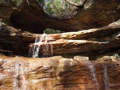
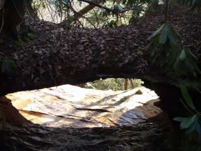
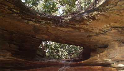
A small stream passes thru this nartural bridge and then cascades off the bluff. Approach from the power line (off-trail). Rockcastle Falls is only a few hundred feet to the east.