Tennessee Landforms -- arches and natural bridges| WGS84 |
| 36.335550 | -84.877670 |
| 36° 20.133'N | 84° 52.66'W |
| 36° 20' 8"N | 84° 52' 39.6"W |
| 16S 690480E 4023258N |
| convert to NAD27 |
Mountain View Arch 100x30
Waypoint: FEA005 36.335550,-84.877670
County: Fentress landforms of Fentress county
Locale: private
NABSQNO 16S-690480-4023258
popup list of
nearby landforms (mileage, bearing)
MAPS
Select one of the following maps to display this waypoint (WGS84).
GPS
Remarks:
References: JNAD:TENN-71,Bob Wheeley
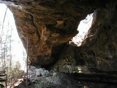 also known as Sam's Arch
Tennessee landforms
home
arches
waterfalls
rocks
peaks
balds
sinks
lakes
regions
county
GSMNP landforms (TN/NC)
BSF landforms (TN/KY)
or nearby
lookout towers
 ©
Tom Dunigan
©
Tom Dunigan