Tennessee Landforms -- arches and natural bridges| WGS84 |
| 36.350860 | -84.852980 |
| 36° 21.052'N | 84° 51.179'W |
| 36° 21' 3.1"N | 84° 51' 10.7"W |
| 16S 692659E 4025005N |
| convert to NAD27 |
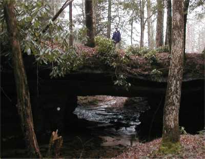
Barn Creek Bridge 18x8
Waypoint: FEA001 36.350860,-84.852980
County: Fentress landforms of Fentress county
Locale: road
NABSQNO 16S-692659-4025005
popup list of
nearby landforms (mileage, bearing)
MAPS
Select one of the following maps to display this waypoint (WGS84).
GPS
Remarks:
References: JNAD:TENN-72
Tennessee landforms
home
arches
waterfalls
rocks
peaks
balds
sinks
lakes
regions
county
GSMNP landforms (TN/NC)
BSF landforms (TN/KY)
or nearby
lookout towers
 ©
Tom Dunigan
©
Tom Dunigan