Tennessee Landforms -- waterfalls| WGS84 |
| 36.098600 | -85.825700 |
| 36° 5.916'N | 85° 49.542'W |
| 36° 5' 55"N | 85° 49' 32.5"W |
| 16S 605707E 3995523N |
| convert to NAD27 |
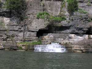
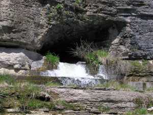
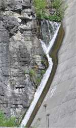
Center Hill Dam Falls 15'
Waypoint: DKF005 36.098600,-85.825700
County: DeKalb landforms of DeKalb county
popup list of
nearby landforms (mileage, bearing)
MAPS
Select one of the following maps to display this waypoint (WGS84).
GPS
Remarks:
Wet weather
falls located below the dam.
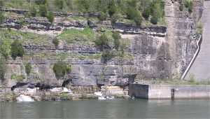 the view from afar
Tennessee landforms
home
arches
waterfalls
rocks
peaks
balds
sinks
lakes
regions
county
GSMNP landforms (TN/NC)
BSF landforms (TN/KY)
or nearby
lookout towers
 ©
Tom Dunigan
©
Tom Dunigan