Tennessee Landforms -- waterfalls| WGS84 |
| 35.944742 | -85.775998 |
| 35° 56.685'N | 85° 46.56'W |
| 35° 56' 41.1"N | 85° 46' 33.6"W |
| 16S 610396E 3978512N |
| convert to NAD27 |
Evins Mill Falls 95'
Waypoint: DKF002 35.944742,-85.775998
County: DeKalb landforms of DeKalb county
Locale: mill
popup list of
nearby landforms (mileage, bearing)
MAPS
Select one of the following maps to display this waypoint (WGS84).
GPS
Remarks:
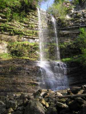
near Carmac Falls
Chuck Sutherland photo 1
or
photo 2
Tennessee landforms
home
arches
waterfalls
rocks
peaks
balds
sinks
lakes
regions
county
GSMNP landforms (TN/NC)
BSF landforms (TN/KY)
or nearby
lookout towers
 ©
Tom Dunigan
©
Tom Dunigan