Tennessee Landforms -- arches and natural bridges| WGS84 |
| 35.973500 | -85.719500 |
| 35° 58.41'N | 85° 43.17'W |
| 35° 58' 24.6"N | 85° 43' 10.2"W |
| 16S 615450E 3981767N |
| convert to NAD27 |
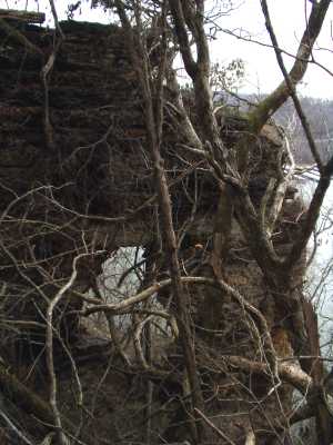
Ragland Bottoms Arch 8x8
Waypoint: DKA001 35.973500,-85.719500
County: DeKalb landforms of DeKalb county
NABSQNO 16S-615450-3981767
popup list of
nearby landforms (mileage, bearing)
MAPS
Select one of the following maps to display this waypoint (WGS84).
GPS
Remarks:
Reference: Todd Fife and Molloy's
60 Hikes within 60 Miles of Nashville
Ye Old Red Post Trail just off the tip of one of the overlooks.
Mother's Day storm '03 left a lot of trees down.
Center Hill Lake info
Tennessee landforms
home
arches
waterfalls
rocks
peaks
balds
sinks
lakes
regions
county
GSMNP landforms (TN/NC)
BSF landforms (TN/KY)
or nearby
lookout towers
 ©
Tom Dunigan
©
Tom Dunigan