Tennessee Landforms -- waterfalls| WGS84 |
| 36.056216 | -84.795825 |
| 36° 3.373'N | 84° 47.749'W |
| 36° 3' 22.4"N | 84° 47' 44.9"W |
| 16S 698531E 3992432N |
| convert to NAD27 |
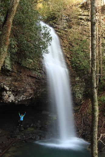
Little Cove Br Falls 60'
Waypoint: CUF011 36.056216,-84.795825
County: Cumberland landforms of Cumberland county
Locale: CT
popup list of
nearby landforms (mileage, bearing)
MAPS
Select one of the following maps to display this waypoint (WGS84).
GPS
Remarks:
Reference and photo: Jason Horton
Tennessee landforms
home
arches
waterfalls
rocks
peaks
balds
sinks
lakes
regions
county
GSMNP landforms (TN/NC)
BSF landforms (TN/KY)
or nearby
lookout towers
 ©
Tom Dunigan
©
Tom Dunigan